The Trail
The photos do not do this path justice. The path offers the diverse vistas of woods and beaches. Biking, walking, and roller blading are all popular on this path. The path is relatively flat and an easier trip for younger people or those looking for a leisurely stroll. We parked at Locust Street in Falmouth where there is public (and free) parking an outhouse.
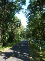
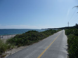

We biked this path in the past but were surprised on our return visit in the fall of 2009 to see that the path was now a lot longer - 10.7 mile long. In the past, the path barely extended past Locust Street on one direction and went down into Woodshole in the other direction. It was a little over 3 miles one way. When we parked in our usual parking area, we saw on the info board that our little path was now 10.7 miles in one direction. We realized that we were going to have a longer ride than we had originally planned. I could not leave without attempting to travel along the path that we had not seen yet.
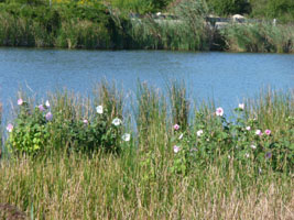

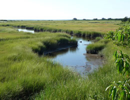
After doing a little research, we found (thanks to an article by George Brennan in the Cape Cod Times that this trail was very new. Built along the right-of-way for the Old Colony rail line into Woods Hole, the Lawrence Lynch Company was given two years to extend the path by about eight miles and within a year we were awe struck with the outcome. The path is well traveled, but not crowded like The Cape Cod Rail Trail can be.
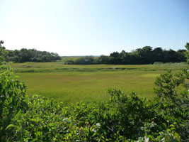


We did the part down to the ocean, and then returned north to the newer part of the path. We peddled through the woods for a while and finally the trail opened up into an area where we could see into estuaries and out over into the water. it was very pretty and along the way, there are little paths that you can take to do bird watching or to go down to the beach. If a sign says Private Property it means exactly that, but there is so much more to see. There are signs along the way noting historical or environmental points of interest, though we never got to see a turtle. We did see many birds and a few mosquitoes, and overall had a really nice time. The trail itself is mostly flat or a low grade hill, so it was certainly on the manageable side for the general paved path biker. We recommend this trail if you visit the Cape.
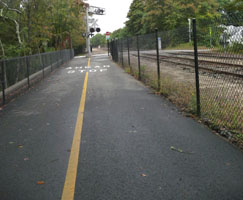
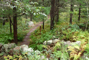

We came back to the path about a year later with friends to go to the newest end and finally made it. We knew we
were at the end when a street sign beneath the stop sign said end. It was one of those things where we kept "getting close"
according to many walking clubs that we passed along the way, even though we knew they were clearly more athletic since
they walked the path in groups on a regular basis and we had just eaten a huge breakfast at Betsy's Diner
![]() ,
but the grade was slightly down hill at least to the end, and after all this time we finally know what the end looks like.
,
but the grade was slightly down hill at least to the end, and after all this time we finally know what the end looks like.
Getting There
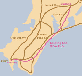
Locust Street parking in Falmouth
From the East
Take Route 28 through Falmouth from Mashpee and continue though the village where there is a stretch of grass and a few pubs and shops. The road splits, though both go to Locust Street. We take the left one, then turn left on to Locust and the parking is on the right.
Woodshole Parking at Ferries
From the North
Follow 28 from Bourne to Woodshole. Park at the Ferry Landing parking area. The trail is at the far end of the parking lot.
Parking in General
Because of the new extension, there is parking all along the path. We do not know how to get to all of the parking areas. We know the two older parking areas, The Woodshole Ferry parking area at the ferries in Woodshole, which will not work well in the summer, and Locust street next to where the trail crosses the road on Locust street. It is a small lot there, so again. this may be more of an off season, or late day or early hour is your best chance advice.
One place I have tried to line up on google maps is at least close to this spot: ![]() .
We have parked at the two described above, but not this place. There are probably half a dozen other places to park along the path. We were unable to
get a map and an online one was not available at the time that we wrote this.
.
We have parked at the two described above, but not this place. There are probably half a dozen other places to park along the path. We were unable to
get a map and an online one was not available at the time that we wrote this.
Visiting Woodshole
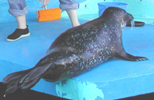
The path ends in Woodshole where you can hop a ferry to Martha's Vineyard or catch a bite to eat. We enjoy spending time at the Aquarium at Woodshole Oceanographic Institute for Marine Biology. It is a small aquarium, but interesting and has seal feedings in the morning and late afternoon. Cost of entry is a donation.
