The Trip
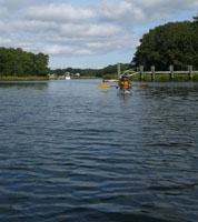
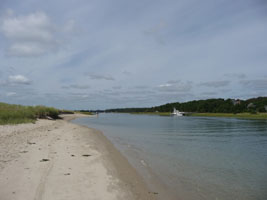
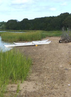
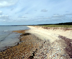
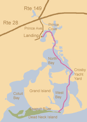
We did our own route rather than the circumnavigation of the Grand Island of Osterville. We started out in Prince Cove and Headed out towards North Bay which is kind of in the leftward direction paddling out from the beach at the dock. Our next main decision of left or right was only a few minutes later which was a left which continued towards North Bay rather than took a dip into a little bay of grasses, birds, and estuaries. We were soon on our way and became a little more certain of our direction.
We came upon a little island that was maybe 20 feet wide that had a sign saying If you don't fly, then bye-bye. Please do not land on this island. We saw plovers and an osprey. It was the closest we have ever seen one fly overhead. There are a few little streams and inlets to explore in this area. We floated by with only gentle paddles and finally took up pace and started to see more signs of the human population. The Crosby Yacht Yard was in sight, and we had been told by the Harbor Master that we could pull up near there and walk close by to grab a lunch. We took a short break and then continued on under the bridge (Bridge Street) that crosses on to Little Island. At that point we were in West Bay.
At this point in our trip, water traffic was busier. The buoys were clearly marked and water traffic followed the marked routes. We stayed outside the lanes like we had been taught in our kayak course, and we only crossed the Ways perpendicular. The only tricky part was getting to Dead Neck Island because traffic had a Way out to the Ocean but there is also a Way between Dead Neck Island and Grand Island where you think only little boats or kayaks fit. It is actually frequently traveled traffic.
Dead Neck Island is mostly protected with fencing, and you can walk along the edges or on the marked trails. The Audubon Society has it set up to protect the birds as a sanctuary and it is very nice. There are absolutely no pets allowed on the island, so if you kayak with your dog, this is not the right destination for you, otherwise, this is a very nice treat, and a great place to picnic and rest up before the return trip. We returned along the route we came from, but our book reccommended a return via Cotuit Bay to North Bay and back to Prince Cove Landing.
Getting There
Places to put in are getting more and more limited. Town permits are required at many more places now, so we check a day or two before we go to be sure that a drop off is still available. We brought Sea Kayaking Costal Massachusetts published by the AMC, and selected trip number 36 as this seemed a lot easier than the others. This book is more advanced in trips than I am usually up to, but it still has a few places that I find useful. We went over the landing points on the map with the Harbor Master at Prince Cove Landing and found out that we were really at the only place that we could park our car at without a permit. The fee at this time was $8 for a car without a trailer.

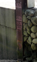
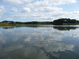
Photos: Leaving Prince Cove Landing, Water marker showing high tide for Hurricane Bob at the top, The view in front of us
We found this landing by traveling along Route 28 towards Marstons Mills, and across from the turn off for Route 149 there is a tiny road with a sign signifying Prince Avenue. Take this road and the landing will be on the left. We did not believe this at first as it simply looked like a beautiful little neighborhood, but there is surely a parking area and a landing around the bend. Someone at the lot will direct you as to where to unload and then where to park.
