General Information
The Gunks offers many miles of biking trails with additional riding in the Minnewaska State park down the road.Many of the trails are simple, though there are more challenging hills in some sections. On this page, we have included maps for both places.
"Rules"

When biking at the Gunks, there are several rules that must be followed per the pamphlet handed out when you register your bike that are of interest...
º Pay the entrance fee or get an annual pass
º You must wear an approved biking helmet
º Ride only on marked carriage ways except for the cut-off from Mossy Brook
Road to Laurel Ledge, and from Old Stage Road to Home Farm Circle.
Obey the "No bicycling" signs
º You can not bike at Skytop, Eagle Cliff, the Mohonk Mountain House and
lake, and the Mohonk Golf Course.
º Do not throw any trash on the trails or in the woods. Pack out cigarettes,
food and tissue for proper disposal.
º Maximum speed allowed is 15 mph.
º Slow down to 5 mph when passing a pedestrian
º Never ride your bike (or step on) a climbers rope
º Stop your bike when a horse approaches, and wait until they pass before
you start up again
So basically, please see a ranger to get an official map with official rules. The maps and rules on this page are meant to help you plan ahead before you make your visit to the park, but can not be used instead of checking in with a ranger. We are just two people who visit the place and are not affiliated with the park.
Gunks Trails

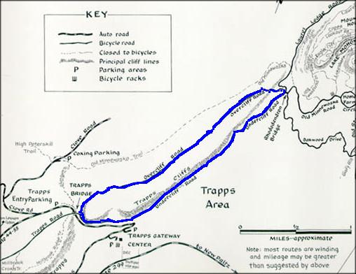
For a real simple route that can even be done on a very rainy day, we like the Undercliff Road to the Overcliff Road. The trail is mostly down hill on the Undercliff Road. When you turn on to the Overcliff Road, it climbs for a short while and then evens out. The last part is entirely down hill.
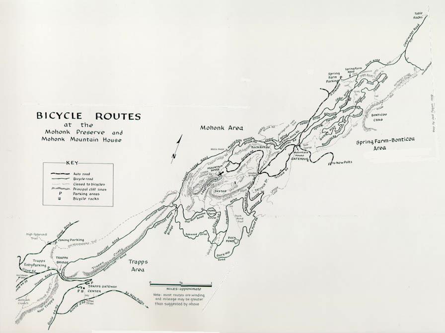
There are many more trails that wander throughout the preserve. It is easy to get lost, and it is best to get a map from the ranger when you pay your fee. Below is a copy of the map, but concatenated to fit one part of the map to the other part of the map, whereas the actual map splits the trails into two drawings. Click on the map below to get a larger image to view or print.
Minnewaska State Park
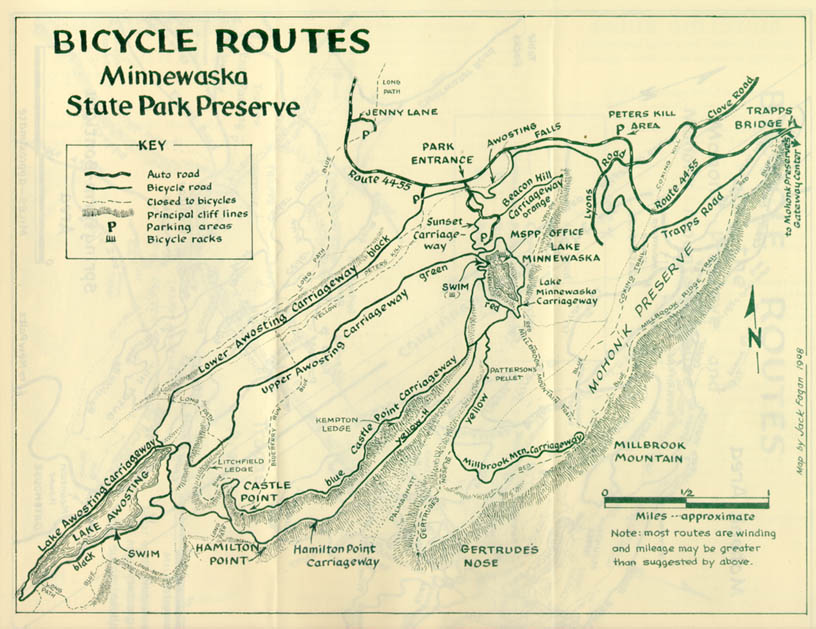
There is biking at the local Minnewaska State Park. Click the map below for a larger image of the map.
Maps
Even enlarged, these maps may not be the best of guides, but they can give you a sense of the extent of the trails and when you get there you can get a better map.


