Getting There
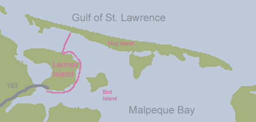
Getting there was not too difficult. We took 2 to 12 to 122 to 131 to 167 to 169 to 163 which crosses over the bridge on to the Island. At which point we went right and then turned right into the Visitor's Center. Sounds complicated, but actually the map it is pretty straight until you get to 163. Our recommendation is to buy a map and figure it out.
Kayaking

We launched behind the new visitor's center and headed east around the island. The plan was to circumnavigate the tiny island. it was a good plan. On a map it even looked like a doable plan. If we could read a map better. Which we couldn't. So when we got half way around, we thought we were only a quarter of the way around. Because when tiny islands are to your back and you go around a corner, one disappears behind the trees on the nearby shore, etc. etc. So you can see where this is going (or not going).
