General Information
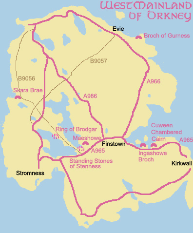
The West Mainland of Orkney is perhaps the most interesting and diverse of the
islands to visit. Access to other islands via ferry from this island is easy,
and airport access as well as ferry access from the mainland make getting there easy.
We visited Orkney in September and found the weather to be quite nice, and since
the crowds were gone, we were able to get our car on to the ferries without having
to reserve ahead of time. There was never any traffic, either.
We camped in Evie while we visited, though there are a few bed and breakfasts
scatters around the island, and a few hotels in Kirkwall.
It takes 3 or more days to see just this island alone, though it is incredibly tiny in size.
The island has many prehistoric sites, Skara Brae to note, and several stone circles.
The wildlife abounds with puffins in the spring and summer, seals, and a lot of birds.
The center of Kirkwall has a number of little shops and places to eat as well as historic
sites of its own.
We planned our entire trip using this site: http://www.visitorkney.com/ and
considered climbing and found the site http://www.orkney-seastacks.co.uk/
Skara Brae
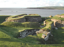
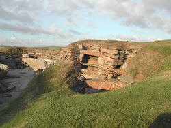
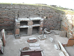
Skara Brae was the focus of our travels to Orkney. The remains of this settlement
are an amazing example of a late Neolithic village, inhabited between 3200 B.C.
and 2200 B.C. by a farming community. They built the eight dwellings in similar fashion.
Each home includes a fireplace, a stone dresser against one wall, and a set of beds
on opposite walls with heather or straw mattresses and sheepskin blankets.
The dwellings built earlier were rounder and the later more rectangular.
The site host a reconstruction close to the gift shop that one can experience
a better feel for how the ancient inhabitants lived. This display closes at the same
time as the gift shop, as does a historic house standing near Skara Brae.
This web site http://www.orkneyjar.com/history/skarabrae/
has more extensive information on Skara Brae and other sites on Orkney.
Maes Howe (Maeshowe)
Maes Howe - we need to go back. For such a small site, an unimposing mound seen from the road,
it covers a vast and diverse history. If you are fortunate to arrive at Maes Howe during
daytime hours, a tour guide is there to explain the significance of the site.
There is a small admission fee, but we found the fee to be well worth it, as both the guide and the site
were fascinating.
The grassy mound covers a 5000 year old Neolithic chambered cairn. It is considered
to be one of the finest on construction from that era. Not much is known about what
the cairn was used for originally. It is clear, however, that in the 12th
century, the Vikings left their mark - literally - in the stone walls. Graffiti
and some drawings still remain on the walls of the inside of the cairn.
The sunlight during the time of the solstice lights up the inside. This is shown on a
web cam that can be found at
http://www.maeshowe.co.uk/ . Starting November 27th (2003),
the web cam goes live so you can watch the progress of the lighting of the chamber by the sun.
This site is also worth the visit to see photographs of some of the Viking writings as well
as to get more information about this historic site.
Ring of Brogar

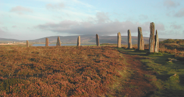
The standing stones were erected and the ditch was dug around them somewhere between
2000 B.C. and 2500 B.C. It was built after Maes Howe and the Standing Stones of Stenness.
There were originally 60 stones, and the ditch was about 5-6 meters wide and about 3 meters deep.
There is no clear picture as to how the stone circle was used, though there is clear
usage of burial mounds close to the stones that can still be seen today.


Standing Stones of Stenness
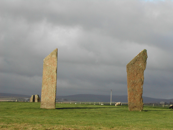
The Standing Stones of Stenness are striking in size (the highest is a little under 20
feet high) and in their setting. This site is one that you see from a distance and it
is just awe inspiring. Dating back to 3000 B.C. these stones predate most in the mainland of Britain.
The Odin Stone used to be a part of the site, but was 'removed' by a farmer in the
early 1800s to discourage tourists who visited the site- much to the dismay of the Orcadians.
Largely unpopular, he experienced several attempts by locals to burn down his home. he
was also successful in destroying one stone from the circle and toppling another before he was stopped.
The Odin Stone was significant for many reasons, and was notably unique in that it had a circular
hole carved through it. It was also claimed to have healing powers. The stone met its
demise only decades ago when a farmer's son ignorantly smashed the remains while cleaning
up the site of a horse-drawn mill, which was its last residence. A heartbreaking
reminder of how artifacts that have survived millennia can be destroyed in an instance though
ignorance.
Cuween Hill Cairn (Neolithic chambered cairn)
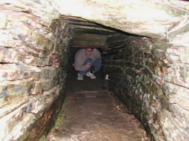
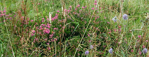
Both Cuween Hill Cairn and Ingashowe Broch are on a small road off of the main road. Exit the main road when you
see signs for the historic sites and take that road until it ends. Cuween is to the right
and Ingashowe Broch is to the left, both a mile or two from the junction.
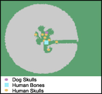
Cuween Hill Cairn is a Neolithic communal burial site dating back to about 3000 B.C.
(or about 4500 years ago - depending on which sign you read) The bones of 8 humans, bones
of ox and birds, and the skulls of 24 dogs were found here. The animal skulls may
suggest rite related to hunting.
After walking uphill through heather, there is an entrance gate with a flashlight (torch)
available to use to explore the inside of the tomb.
Wideford Hill (Ingashowe Broch)
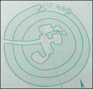 Wideford Hill is a communal burial ground dating back to about 3000 B.C.
The drive takes you uphill along a winding road to a small carpark that fits about 3 or 4 cars.
You can not see the site from the carpark.
The path leads mostly downhill though heather and mud to the site. The walk is about 15 minutes
and can be a bit strenuous of a hike on the way back. If the driver is willing, another person can continue
to walk down hill to the other side rather than walking
back up hill to the car. If they opt to hike the way down, the driver can meet them at the bottom.

